There have been many aerial views taken of the town and local area, this page aims to build up a portfolio of such images.

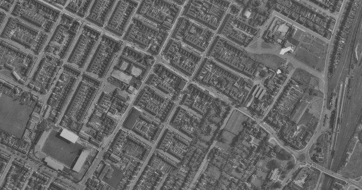
Much can be seen in the early 1960s view of Ashby overlooking the Broadway area. The Roxy Cinema – now The Malt Shovel and the original Mill Road Club building can be seen, further up is The Crown Hotel and the Primitive Methodist chapel.

A wider view of the image above

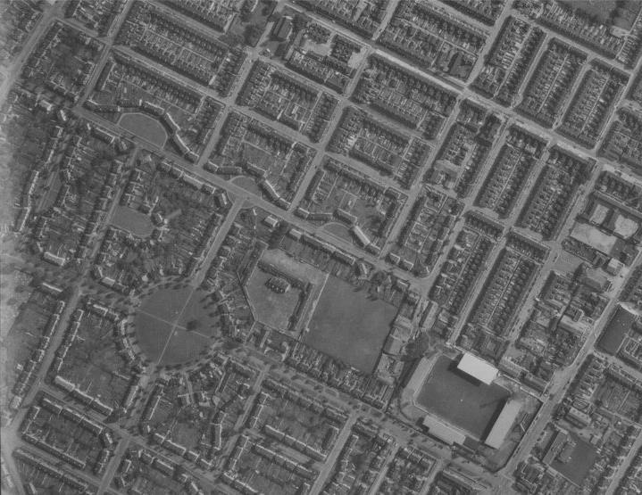
In this early 1960’s view of the town centre the bus station of 1929-1968 can be seen to the lower centre of the photograph, bottom left the new Kirman’s Store is present with their older store slight up from that (at the top of Market Hill). The old market hall of 1906 with the Blue Bell hotel opposite are quite dominant on the High Street and top right is St. John the Evangelist Church with the houses of Carlton Street running in front of it. The former Iron & Steel Club can also be seen on the corner of John Street & Manley Street.
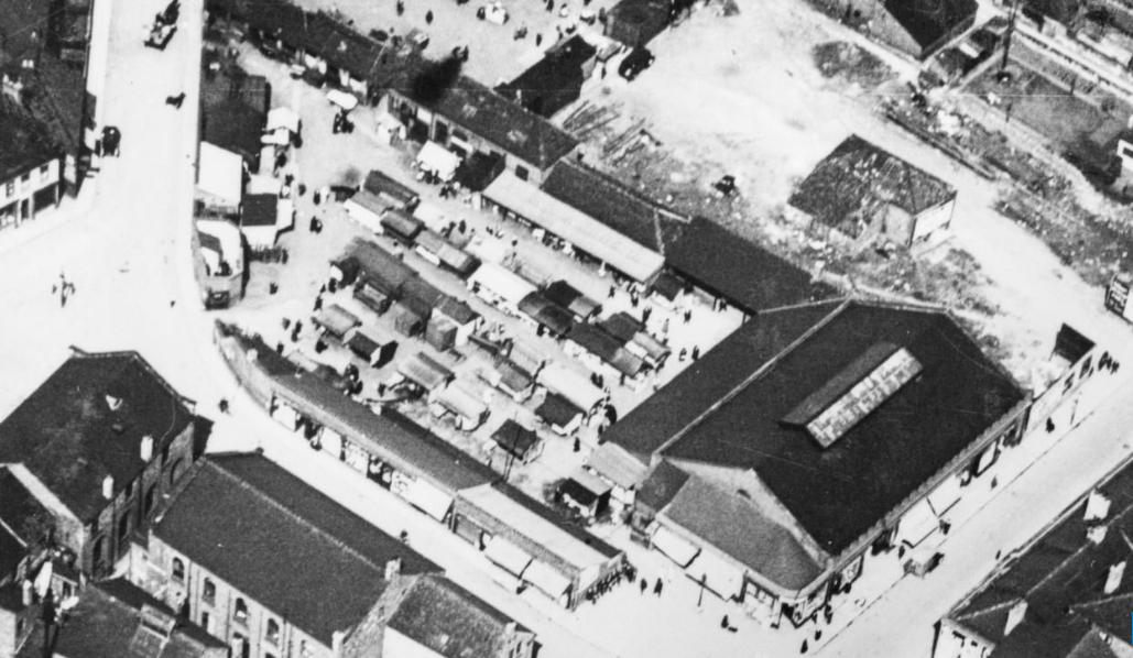
Scunthorpe Market in 1925. It opened in March 1906 and had replaced an earlier smaller market owned by Mr H J Parkinson from whom the rights were bought for a reported £5000 – a further £1500 was spent on alterations including a new market hall. The 1906 market was established under Section 166 of the 1875 Public Health Act following a poll of ratepayers taken on 7th March 1904. The market was held on Fridays and Saturdays along with a fortnightly cattle market.

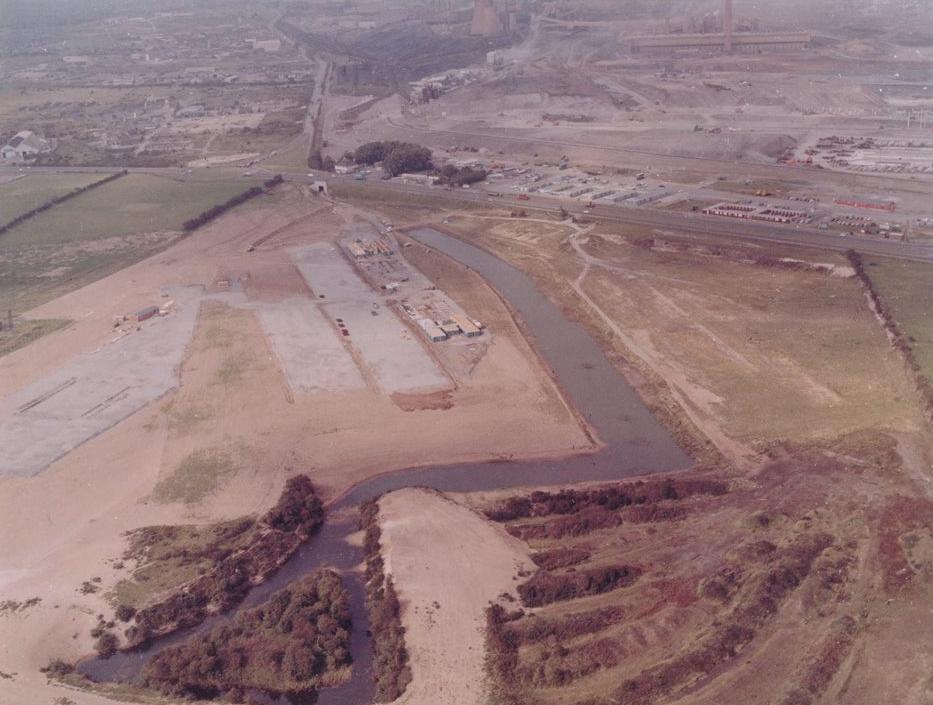
This view of Scunthorpe United’s new home, Glanford Park, shows it’s building progress in January 1988. The ground was ready for the beginning of the 1988-89 season.

A view looking toward the Lysaght’s Steelworks (Normanby Park) in 1950 – Buckingham Avenue and Crosby Avenue can be seen running parallel to each other from the bottom left.

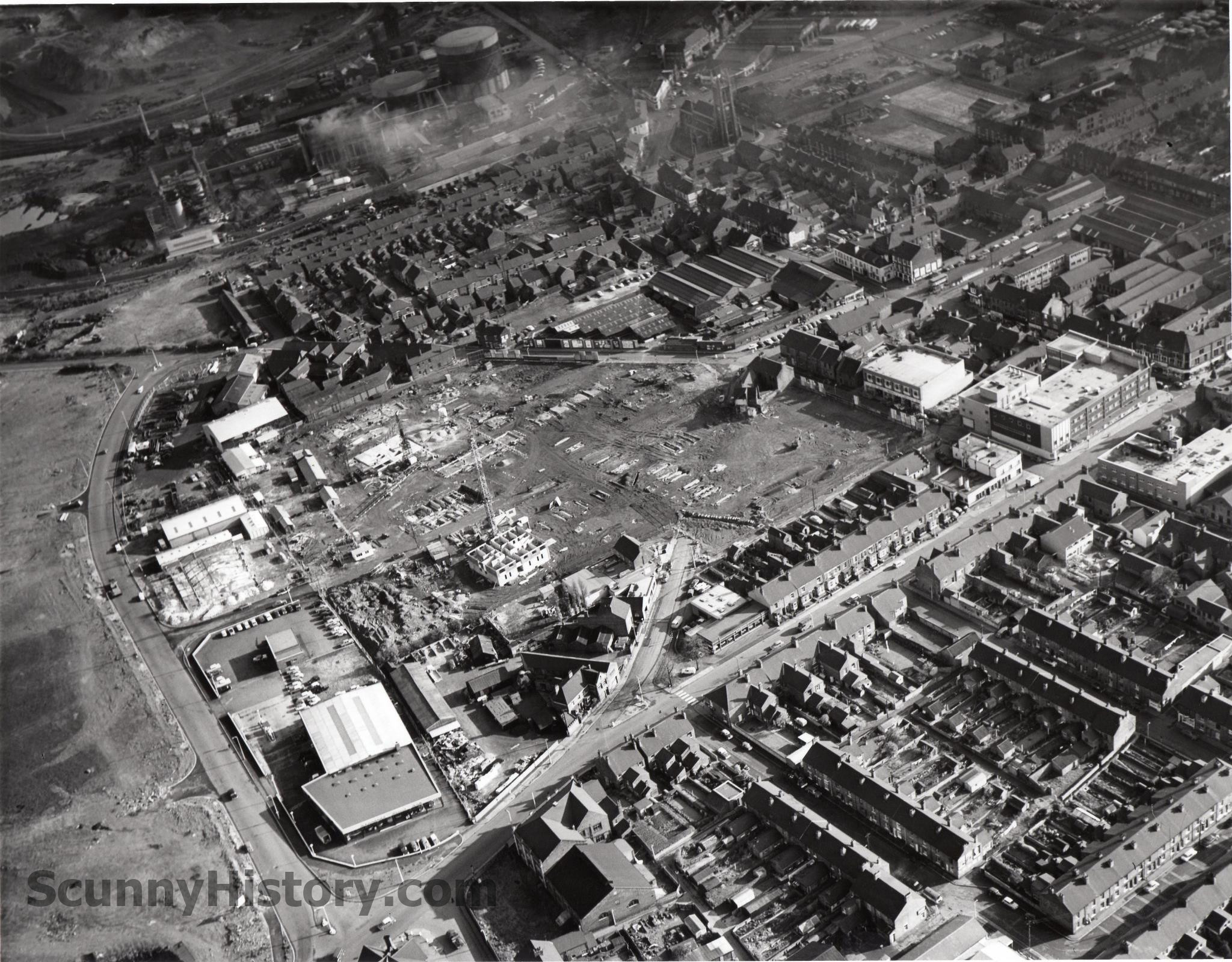
In this view from 1973 much can be seen. The main rail line cuts through the picture with the West Yard sidings, to the left is Rowland Road roundabout and below that is the land where The New Life Church was built. Above the roundabout is the former Co-op warehouse/distribution centre which burned down on 19th March 1995. On the left is the open space where the Model traffic area stood and top centre are the former Station Road playing fields.
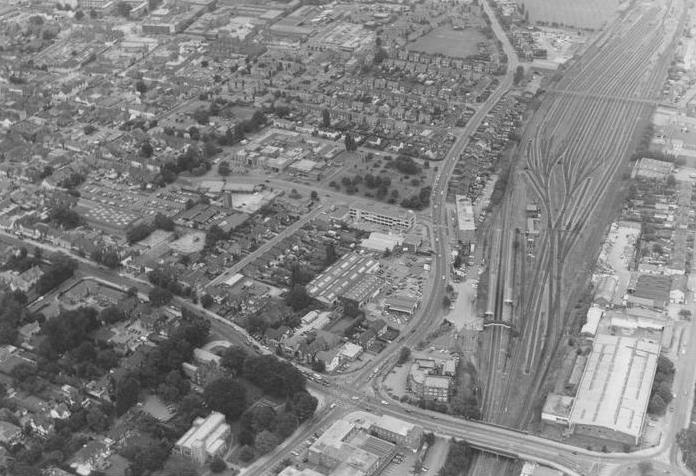
A similar view that the one above taken c1974

This view was taken overlooking Scunthorpe Hospital on 11th May 1950 and shows the distinctive entrance & exit ramp which stood at the front of the new casualty department. Cliff Gardens runs diagonally bottom right and Church Lane top left, the field in between saw massive extensions to the hospital being built on during the 1990’s
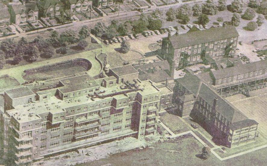
Another view of the hospital taken from the Church Lane side.

A view of Ashby Ville roundabout c.1960
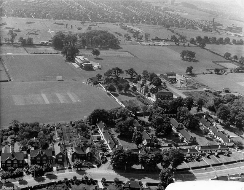
In this mid to late 1960’s view over Brumby Hall. Brumby Wood Lane is seem running left to right along the bottom. Appleby-Frodingham’s sports club can be seen in the centre of their sports grounds whilst toward the upper section of the picture is Central Park and the fountain. Top right is North Lindsey College and above that is Langland House which was renamed Trent View House in the early 1980’s.
Anchor Village was built in the early 1970’s to house construction works who came to the town to build the Anchor Steelworks
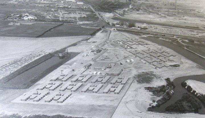
The Anchor Village taken around 1971. It was built to accommodate the thousands of workers who came to the town to build the new steelworks Anchor project.
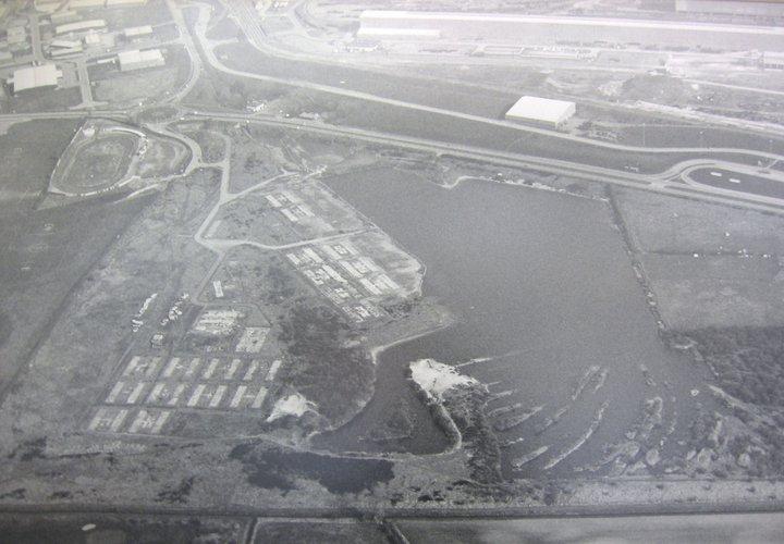
Anchor Village in the early 1970’s with the Anchor Steelworks under construction to the top right.
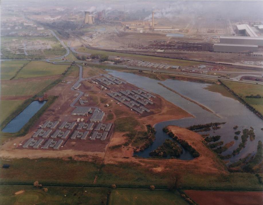
Anchor Village in the mid 1980s.
After the steelworks Anchor project was complete in the mid 1970s the village became unused and slowly became dilapidated, the nearby lake often flooded the lower accommodation units.

An aerial view from 1954.
Running from left to right is Burringham Road, Priory Lane’s Sunnyside Estate which had been newly complete can be seen. To the upper right the roads are laid out for the Manor Farm Estate and to the lower left Asterby Road (minus any houses) can be seen. The plot of land where The Beacon Hotel was built can be seen at the junction of Burringham Road and Willoughby Road and in the distance the fields where Westcliff was later built.

Aerial view of the town centre c1920
The Blue Bell is top right and opposite is the market hall of 1906, top left. On the left centre are the 2nd & 3rd Wesleyan Chapels at the top of Market Hill. Whilst centre right is the fairground where Enterprise & Silver Dawn opened their bus station in 1928.

Keadby coal fired power station

An aerial view of Lysaght’s steelworks during it heydays

An aerial view over the Civic Centre, Central Park and Brumby Sports Ground in the late 1960s

Central Park under constuction 1959.
The park was designed to celebrate the 21st anniversary of the Borough of Scunthorpe which had the charter rights bestowed in 1936. The laying out of the first phase of the park between Festival Gardens and the new Technical College cost £25,755.
In the centre of this picture is the fountain pool which originally contained 3 small fountains but it was reported these had ‘no weight’and when it was windy the water was whipped up and blew across to people watching them. A new contcrete fountain was designed standing at 10ft 9in by engineer John Whittle.
Also, top centre are Kingsway Flats under the latter stages of construction.
This aerial view features the Civic Centre (above) in the middle with central Park to the left and Brumby Sports Ground to the right. The foundation stone for the Civic Centre was laid in 1959 and it was officially opened on 10th April 1963 by Alan James Peach at a cost of around £430,000. In the 1990’s it was renamed Pittwood House after Edwin Pittwood, Mayor of Scunthorpe in 1949/50, but has since been reverted back to its former name. On the right hand side is Brumby Hall Sports Ground with the bowling greens, the Social Club can also be seen beside some trees. Brumby Hall is visible to the right of the Social Club and the old Firth Brown’s ground is immediately to the west of Brumby Hall. To the left of the picture is Central Park with its fountain, hot houses & aviary and paddling pools. Bottom centre is the new Scunthorpe Baptise Church which opened here after moving from their previous site on Doncaster Road.

This view of Gravel Pit Farm at the junction of Yaddlethorpe High Street and Endcliffe Avenue is much changed from the scene today.
In this mid 1960s view over the Frodingham & Brumby areas we can see the Rowland Road roundabout had yet to be constructed, there is however the roundabout at the junction of Oswald Road/ Station Road and Church Lane. To the bottom right the steelworks tennis courts can be seen at the unction of Oswald Road and Cliff Gardens – this now has a housing development on it called St. James Court. Also in this view the Co-op Warehouse/distribution centre can be seen under construction.

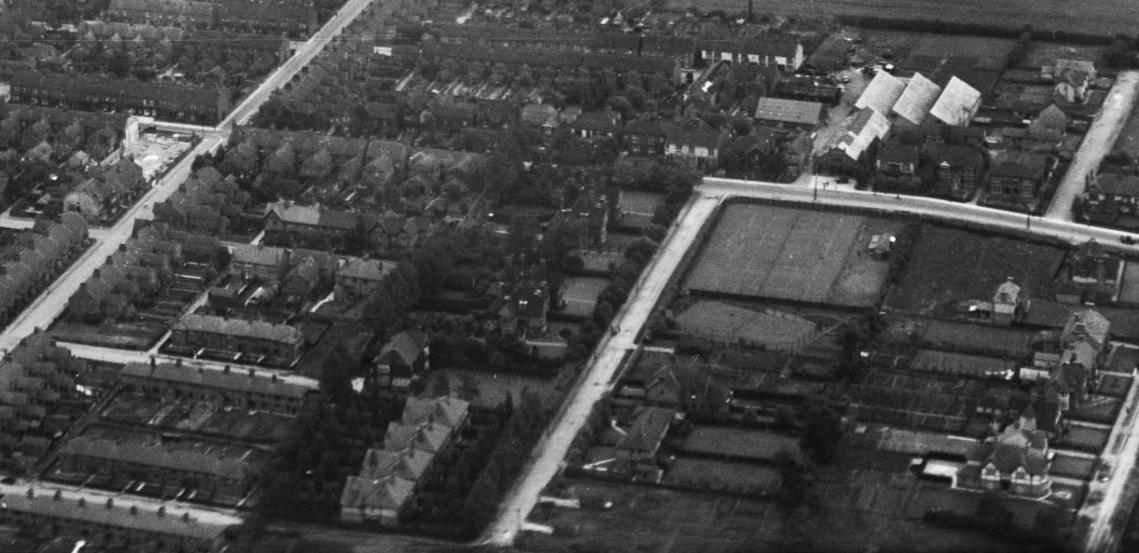
The Model Traffic area opened in 1958 and was designed to teach children road cycling safety, over 12,000 school children were taught here by PC Reg Wood but in June 1977 it closed because road safety experts considered it did not reflect the present-day road conditions. It was maintained as an open space until it was sold for redevelopment. The Civic Theatre, also opened in 1958, can be seen and behind it the Charter Hall. Across the road from the Civic Theatre is the land where the current Fire Station was built.

In the centre of this view from c1962 groundwork can be seen at the commencement to build the Woodlands Crematorium – it opened in 1964, the Grandstand at Quibell Park can be seen but not the veledrome & running track. The rail line is running from the bottom left to top left of the picture whilst Scotter road runs bottom left to right. The A18 Kingsway is seen curving top left with Central Park above it.

In this early 1960s view over the town centre we can see to the left is the old Market Hill area which was redeveloped in the mid 60s and now contains the 3 high rise flats and maisonette complex. In the centre is the old High Street are which made way for the new precinct in the late 60s.

A closer image to the one above.
This view of the Market Hill redevelopment from early 1964 shows the construction of Crosby’s High Rise Flats.

Aerial view of building in progress during the Market Hill development c.1965
The development resulted in 3 multi-storey tower blocks and maisonettes, it was opened in March 1966 by the Rt. Hon. Richard Crossman M.P., the then Minister for Housing and Local Government.

This snowy view from 1969 over the Westcliff sees West Common Lane running up the left side of the picture with John Leggott College towards the top. On the centre right is Langland House (now renamed Trent View House) casting a long shadow.

In the centre of this view from the late 1950’s is the former Model Traffic Area.

Scunthorpe United’s former home, The Old Show Ground, features in this 1968 photo.

An aerial view over Scunthorpe Town Centre in the late 1950’s

In this view, taken from the top of Crosby Flats in the early 1970’s, the rear of Scunthorpe Market is to the fore. Running from bottom left to the centre is Home Street with the S&G Stores on the corner with Scunthorpe High Street. The new Market Foodhall (which opened in 1972) is centre right and above that a tower crane is being constructed for the building of the new library which subsequently opened in 1974. In the centre is St. Johns Church with the Iron & Steel Club to it’s right.

This view looks east over Scunthorpe in 1926. The Old Showground is bottom left with the newly named Doncaster Road running to the side of it.

A view overlooking the Henderson Avenue Estate during construction in the 1920’s – towards the top right is the Old Showground.

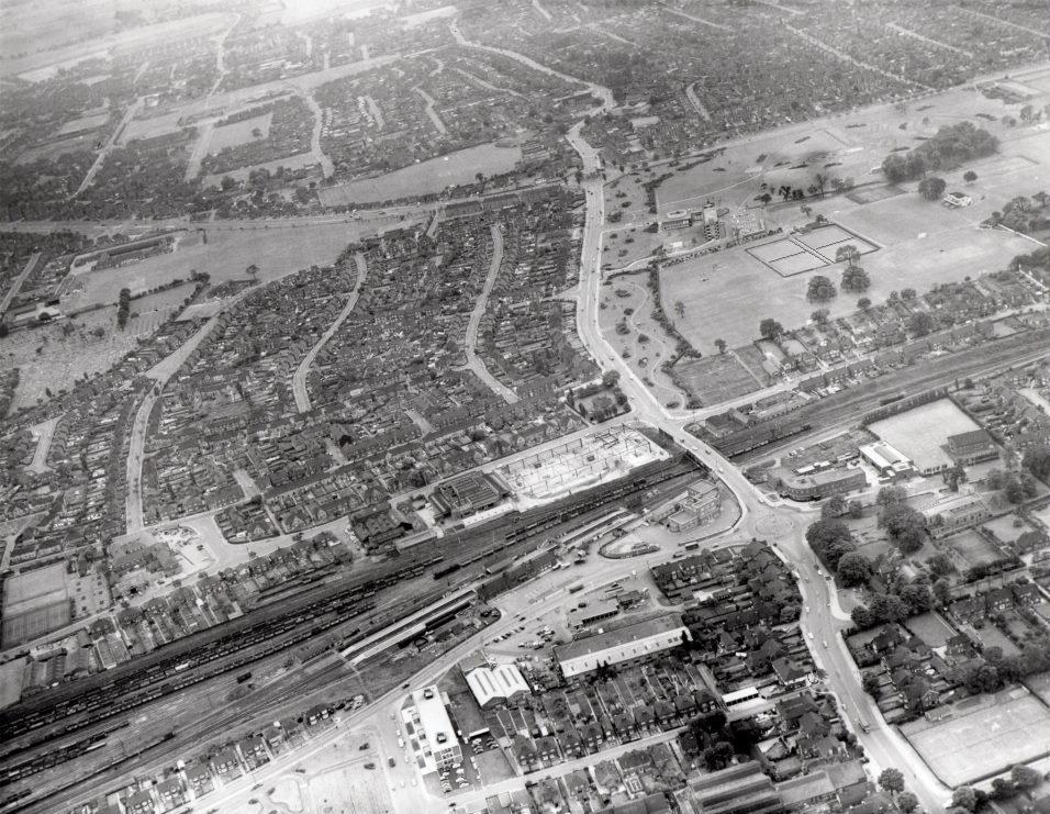
In this early 1960’s view overlooking the east of the town and the steelworks the familiar St. John the Evangelist Church can be seen to the lower left with Carlton Street running in front of it. Just north of the church, and to the right of Dawse Lane, was the earliest ironstone pit which served the Trent Ironworks. To the top right of the photo are the sprawling Appleby & Frodingham steelworks.

This view swings to the left of the photo above. St. John the Evangelist Church is to he lower right with Dawse Lane going off in a straight line behind it. To the left of the church is a residential Trafford Street and the towns gas works above it, these gas works replace the former gas works which stood on Doncaster Road in 1925.
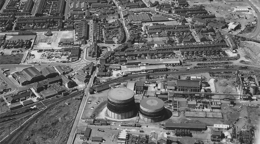
Taken from the east of the town in the late 1950’s the foreground is dominated by the towns gasworks, up from there is Hornsby & Goodwin’s stockyard followed by Trafford Street. St. John the Evangelist Church can be seen towrds the centre and further up to the right is the Blue Bell and the old Market Hall.

Looking down from directly above the town centre in the 1950’s to the bottom right is Scunthorpe United former home, The Old Showground. Lower centre of the photo is the cemetery and the roundabout seen top right is at the junction of Station Road, Oswald Road and Church Lane.
This 1926 view shows Cliff Gardens running upwards, from bottom centre to its junction with Oswald Road. The tennis courts of the North Lindsey Tennis Club can be seen at this junction – this land was sold in the early 1980’s and houses now stand here. Directly opposite on Oswald Road are the premises of the Clark & Company Limited motor engineering works. The road seen running to the left (top to bottom) is Mary Street where at its junction with Oswald Road the construction of the Majestic Cinema in underway – this opened in 1927 and closed in 2002, after it was demolished the land stood vacant for a number of years before an apartment complex was built on the site.
Taken in 1959 this aerial view shows the newly completed cantilever stand at The Old Showground.
Taken in 1959 overlooking the Old Showground and Henderson Avenue Circle

In this mid 1950’s view Brigg Road is running from the bottom to the top, the first road running off to the left is East Common Lane and then further up are Cottage Beck Road and then Rowland Road. The right is dominated by the steelworks.
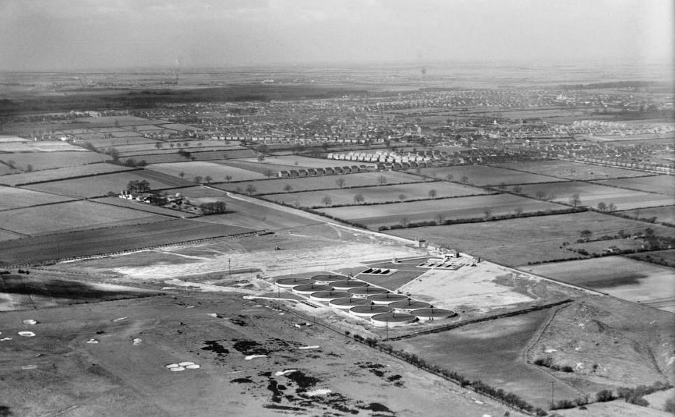
Ashby Sewage Works are to the foreground with Ashby and its environs seen in the distance.


May I ask where the original source for the colour photograph of the Anchor Village comes from? I would be interested in making a high quality scan.
Thanks,
Adam
I was sent to us by one of our contributors
BAN GCE was written on the grammar school roof in 1961 and I got blamed for it although I did not do it! I once saw an aerial photo in the Evening Telegraph that showed this dirty deed. Their archives don’t seem to have a copy, but has anyone else got one to share? I alway wonder who actually did do it!